My Projects
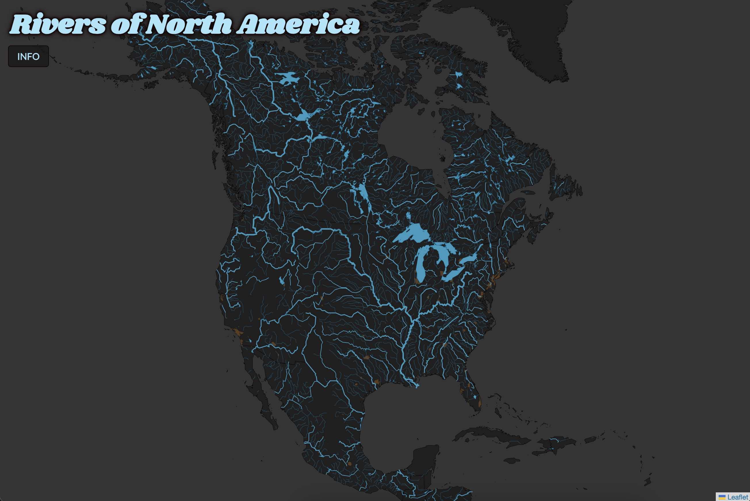
Rivers of North America
This exercise uses a PostGIS database to create a map of the rivers of North America. The map is created using Leaflet. The map is interactive and allows the user to explore the rivers of North America.
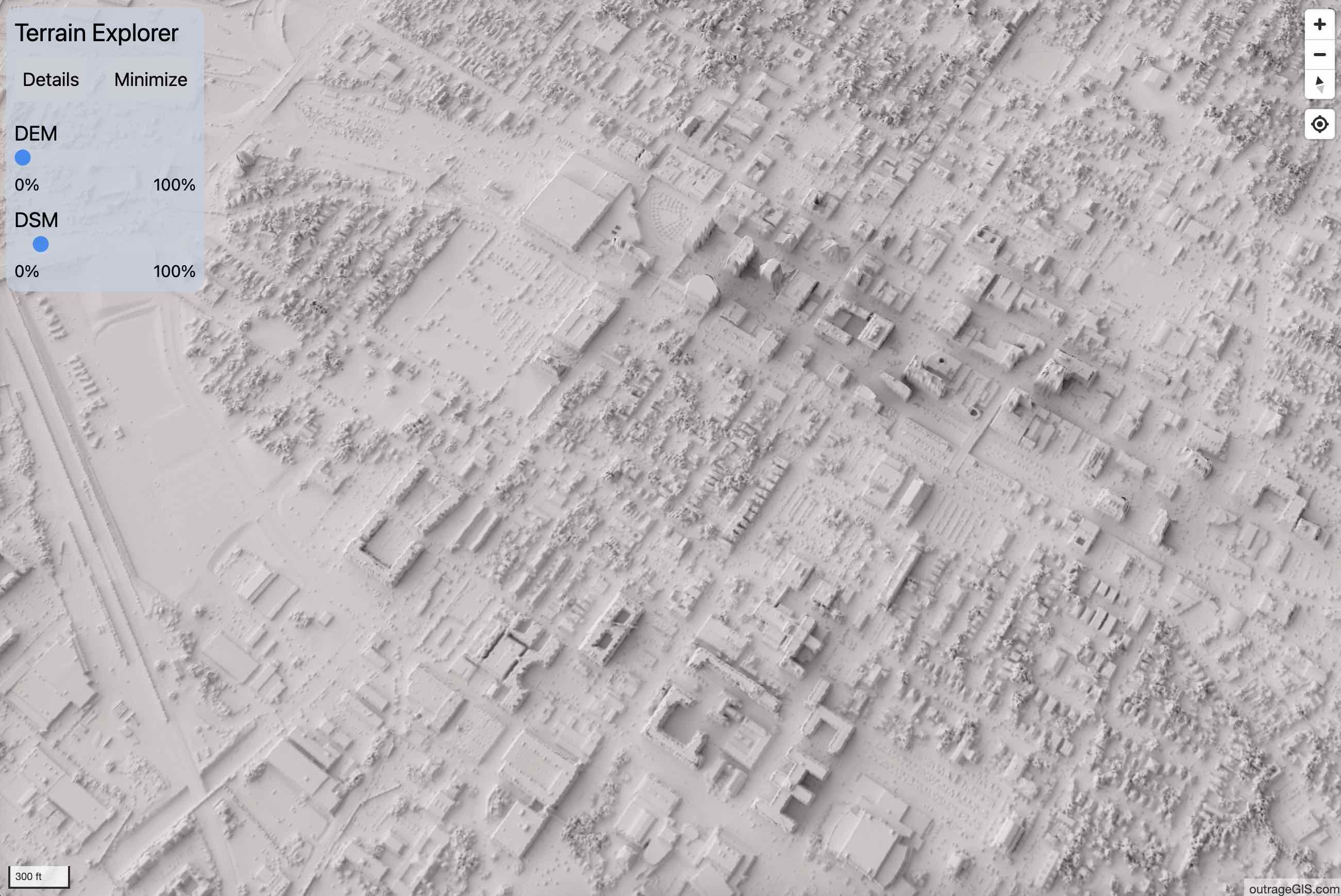
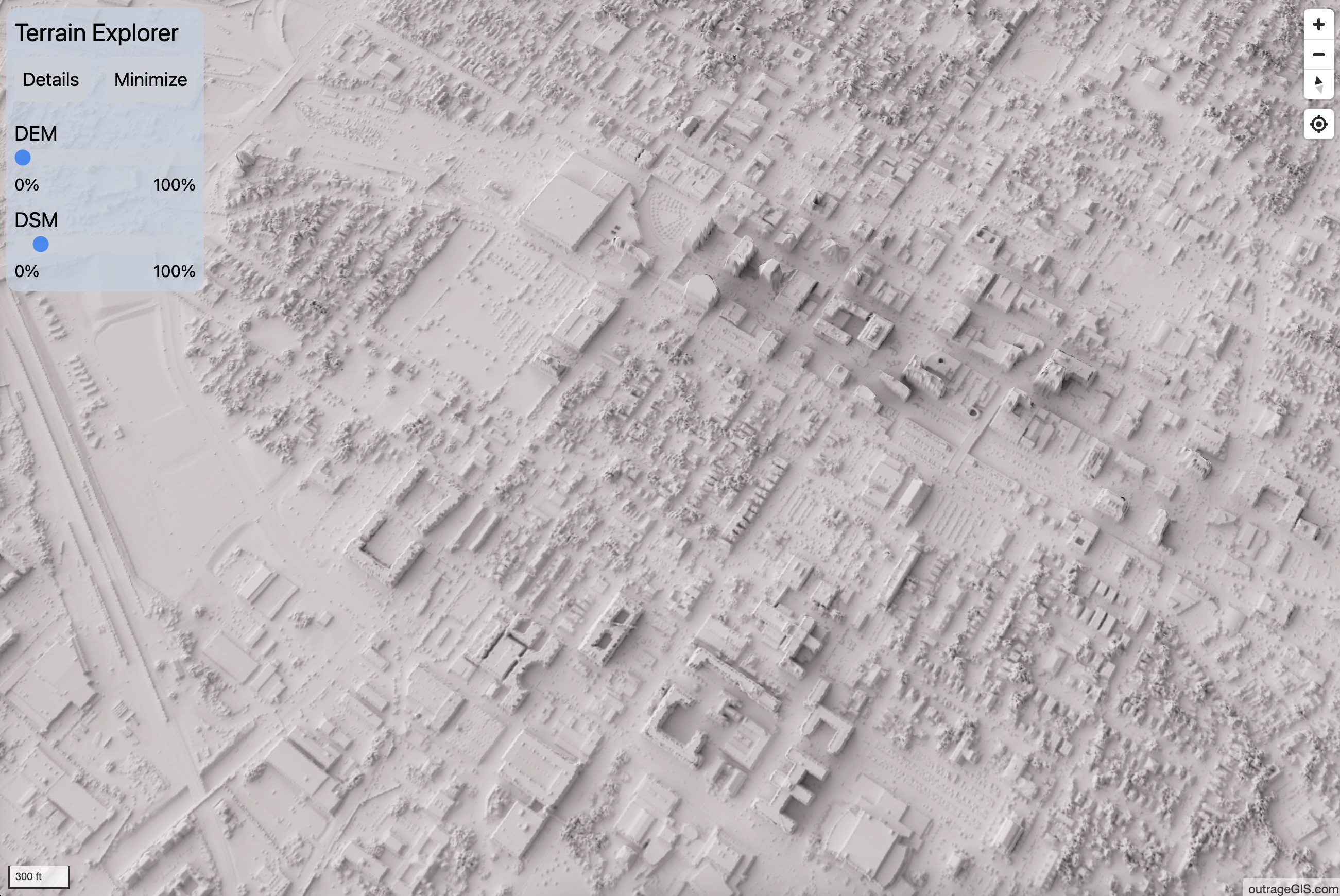
3D Explorer
This MapLibreGL project shows a 3D map of the terrain of Lexington, Kentucky. Users can select the terrain as a DEM or DSM, and vary the exaggeration factor. Users can also record and download GPS tracks of their travels.

Great Smoky Mountains
When Avenza made their offline mobile app for maps, I published my Great Smoky Mountains hiking map in a digital version. It's a great way to explore the park without cell service. The map is available for download.

Campus Change, 2010-2019
Kentucky has two, state-wide lidar datasets roughly 10 years apart. This project uses the two datasets to show the changes on the University of Kentucky campus, including new building construction and tree canopy changes.

Postcard from Puerto Rico
Maps make great postcards. This design shows the sights and geography of northeastern Puerto Rico. Who's up for a trip to Old San Juan?
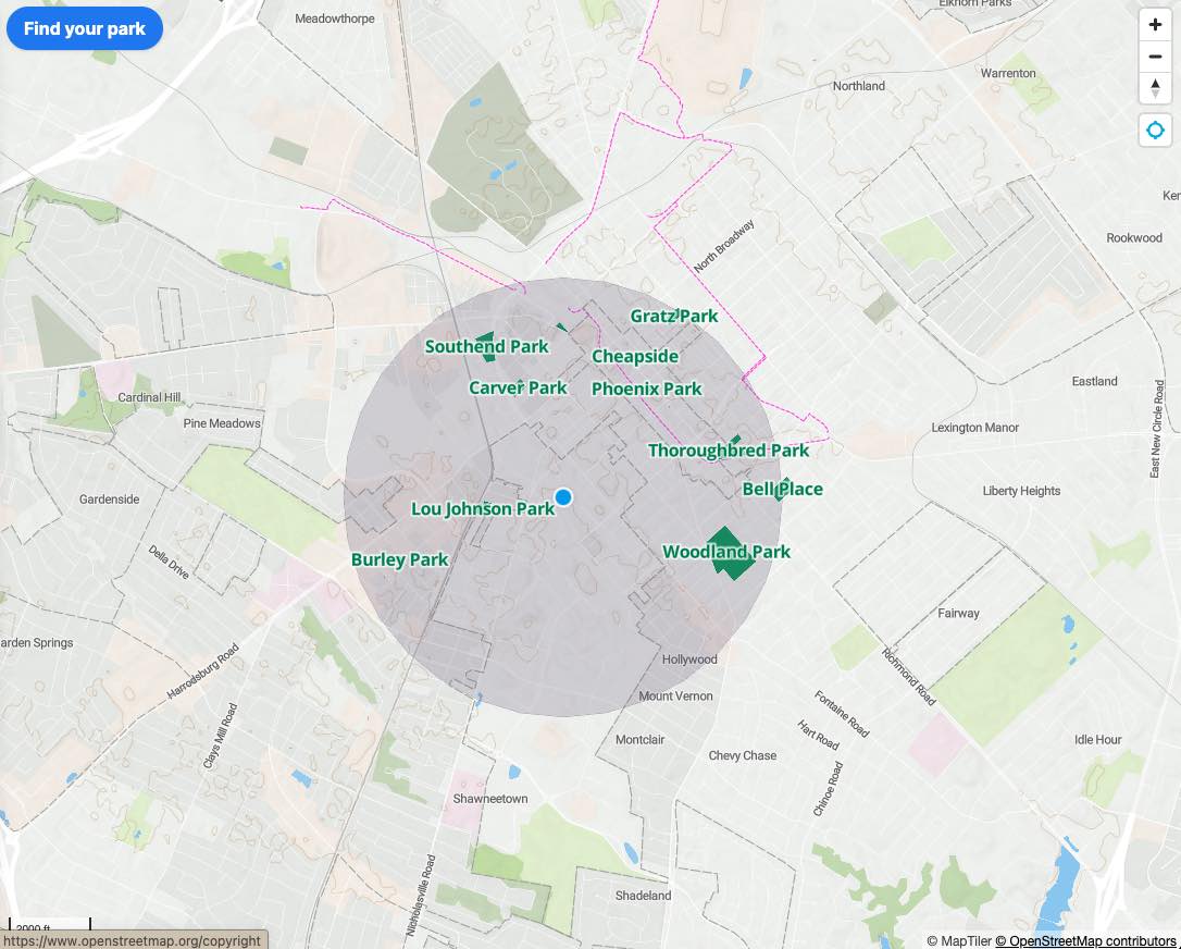
Find a park
Find a park within one mile of your location. Just click the geolocate button and see what's nearby. It will show the parks in your area and provide a list detailing the distance from your location, the park name, and the park acreage.